Round Lake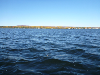
Waawiyegamag
Description and Background
Round Lake is a small shallow spring-fed lake with a surface area of 353.4 acres. There is one inlet creek connected to the north arm of Spring Lake and an outlet creek connecting to Crooked Lake. Round Lake is part of the Lake Huron Watershed. Historically, Odawa people frequently portaged their canoes over the sand dunes near Petoskey to and from Round Lake and then followed river courses connecting Crooked, Burt, and Mullett Lakes to Lake Huron. These connected water bodies are collectively called the Inland Waterway. Adjacent to Round Lake is the location of a historical Odawa event called the Hiawatha Pageant.
Round Lake’s present land coverage consists of seasonal and residential homes, condominiums, two nature preserves (Fotchman and Round Lake), a small beach, and a public boat launch and access site. An area of Round Lake is buoyed off to minimize disturbance of the loon’s nesting area. There is a diversity of waterfowl on this lake as well. There is a population of walleye in Round Lake and fishermen frequent the lake, especially in the winter. Recreation is the dominant use on this lake. There is one monitoring location on Round Lake where data is collected at mid-depth of the water column approximately 2.1 meters.
Tribal Uses and Attainment
The primary Tribal use on Round Lake (RDL) is WF. Round Lake has been stocked by the MDNR in the past with walleye. The last stocking was in May of 1998 according to the MDNR fish stocking website. Stocking has not continued by the MDNR because the department believes natural reproduction productivity is absent or minimal for walleye. Warm water fish in Round Lake according to LTBB NRD fish surveys conducted in summer and fall of 2009 consist of but are not limited to blue gill, sand shiners, rock bass, northern pike and largemouth bass. LTBB fish surveys conclude that Round Lake is a viable warm water fishery with natural reproduction of warm water fish species (Haynes, 2009). Oher Tribal uses applied are IAW, WF, TCCU and PC (May through October). All uses are supported.
LEGEND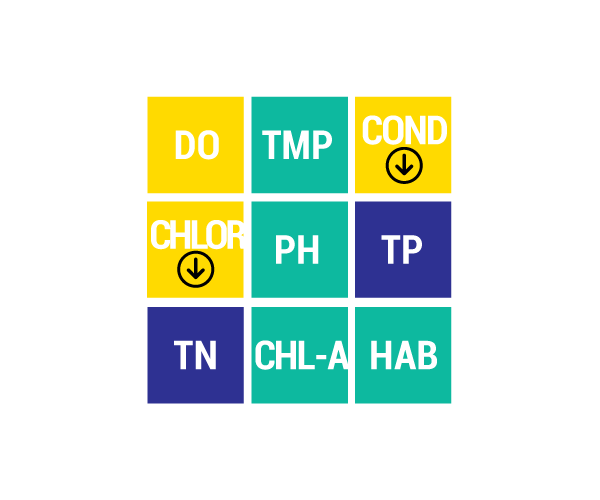
DO Dissolved Oxygen
Respiration for fish, other aquatic organisms
TEMP Temperature
General aquatic life support and reproduction
COND Conductivity
General aquatic life support, dissolved solids indicator
CHLOR Chlorides
General life support, salinity indicator, drinking water pollutant
PH Potential Hydrogen Ion Concentration
Acidity/alkalinity indicator, drinking water pollutant
TP Total Phosphorous
Major algae nutrient, fertilizer/manure runoff indicator
TN Total Nitrogen
Major algae nutrient, drinking water pollutant, fertilizer/manure runoff indicator
CHL-A Chlorophyll-a
Algae concentration indicator
HAB Habitat
Instream and riparian structure to support life cycles of fish and other organisms
MAC Macroinvertebrates
Indicator of water quality based on the diversity of pollution tolerant and intolerant
aquatic insects and non-insects that are visible to the naked eye and do not have a backbone
TSS Total Suspended Solids
Indicator of aquatic life support, oxygen levels
FQA Floristic Quality Assessments
Indicates quality of wetland based on the plant community present
CONDITION INDICATORS
Poor Fair Good Very Good