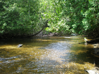
Boyne River
Description and Background
The Boyne River is a cold water river system with three branches approximately 24 miles in length. This river is adjacent to and affects the waters of the LTBB historical reservation. The river drains into Lake Charlevoix. The northwest shoreline of the main basin of Lake Charlevoix is the southwest boundary of the LTBB historical boundaries. The Boyne River has a drainage base of 40,320 acres and is the second-largest tributary of Lake Charlevoix.
The Boyne River is a well-known cold water fishery with fish species such as Chinook salmon, walleye, brook trout, brown trout, and rainbow trout inhabiting the river.
The Boyne City Mill Pond is located about a mile upstream of Boyne City where the river drains into Lake Charlevoix. There is also an active hydroelectric dam upstream of the mill pond used by a local ski resort for power and snow-making. Upstream on the south branch there is another old dam built in the 1900’s that used to be used to power a saw mill and grist mill.
Two sites were monitored seasonally on the Boyne River during the 2013 field season. The site farthest upstream, BNR3, is located just below the old dam in Boyne Falls on the south branch. The site furthest downstream, BNR1, is located just upstream of where the main branch of the river discharges into Lake Charlevoix in Boyne City. Quantitative pebble counts are completed at the past LTBB mid-river site, BNR2. This is the only parameter completed at BNR2 due to this river section being very active with fisherman and kayakers.
Tribal Uses and Attainment
The Boyne River’s Primary Tribal use is CF. Other uses applied at both sites are SF, TCCU, IAW, PC (May through October). All uses are supported at both sites on the Boyne River except SF needs further evaluation based on a lack of toxin data in fish and data on how much fish Tribal families eat for subsistence.
LEGEND
DO Dissolved Oxygen
Respiration for fish, other aquatic organisms
TEMP Temperature
General aquatic life support and reproduction
COND Conductivity
General aquatic life support, dissolved solids indicator
CHLOR Chlorides
General life support, salinity indicator, drinking water pollutant
PH Potential Hydrogen Ion Concentration
Acidity/alkalinity indicator, drinking water pollutant
TP Total Phosphorous
Major algae nutrient, fertilizer/manure runoff indicator
TN Total Nitrogen
Major algae nutrient, drinking water pollutant, fertilizer/manure runoff indicator
CHL-A Chlorophyll-a
Algae concentration indicator
HAB Habitat
Instream and riparian structure to support life cycles of fish and other organisms
MAC Macroinvertebrates
Indicator of water quality based on the diversity of pollution tolerant and intolerant
aquatic insects and non-insects that are visible to the naked eye and do not have a backbone
TSS Total Suspended Solids
Indicator of aquatic life support, oxygen levels
FQA Floristic Quality Assessments
Indicates quality of wetland based on the plant community present
CONDITION INDICATORS
Poor Fair Good Very Good