General Election: June 28, 2021 Candidates for Tribal Council
RICKY COMPO
TAMARA KIOGIMA
LEROY SHOMIN
DOUG EMERY
WILLIAM ORTIZ
MARCI REYES
KENNETH DEWEY
AARON OTTO
SHARON SIERZPUTOWSKI
SIERRA BODA (WITHDREW 5-14-21)


Big Sucker Creek is a perennial stream that originates from O’Neal Lake and flows into Lake Michigan. It is slightly over 3 miles long. The land surrounding Big Sucker Creek is owned by the State of Michigan. The land that the creek is located in is managed by the State of Michigan Department of Natural Resources (MDNR) and is completely within the boundaries of Wilderness State Park. The land cover is forested and forested wetland. The area in which the creek meanders is remote and is only exposed to minimal disturbance by human land use activities. The creek is used by recreational fisherman and the land is used by outdoor enthusiasts such as hikers, campers, snowmobilers, bikers and birdwatchers.
There are currently two areas of creek that are monitored. The upstream site, BSC1, is directly downstream of the headwaters of the creek below the dam at O’Neal Lake. In early fall of 2014, the dam failed leaving the lake to begin draining into Big Sucker Creek. The data summary tables will show if this draining caused change to the parameters measured and will be summarized in the narrative summary section.
In 2011, BSC1B was added to the monitoring design. BSC1B is the downstream site and is located at the mouth of Big Sucker Creek. This site is in a remote area and requires more than a mile hike with large equipment on rugged terrain. Therefore, WQPP staff will strive to complete sampling but will not sample without two staff present to address safety concerns.
The area adjacent to BSC1B is listed in the Federal Register as a determined Environmental Protection Agency Critical Habitat area for Endangered and Threatened Wildlife and Plants. The piping plover uses this area as a nesting area and endangered plants such as Pitcher’s thistle grow along the shoreline near where the creek drains into Lake Michigan.
The Primary use for Big Sucker Creek is IAW. Other Tribal uses applied are CF (at the downstream site) and WF at the upstream site, TCCU and PC (May-October). The upstream site has been classified as a warm water fishery due to location of the site. O’Neal lake’s water is largely groundwater and spring fed, however, the lake level is shallow which allows for the water to heat up based on seasonal air temperature and may not be conducive to cold water fish species. Downstream however, at the mouth, the creek has been fed by springs and groundwater seeps throughout its meander through a very shaded lowland wetland. Steelhead/Rainbow Trout were observed in the downstream section of the LTBB monitoring site in the spring of 2014, along with a large population of White Sucker fish. Both sites supported all uses assigned.
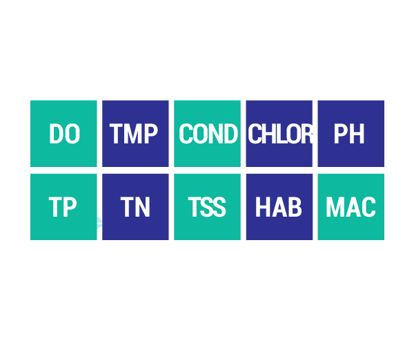
DO Dissolved Oxygen
Respiration for fish, other aquatic organisms
TEMP Temperature
General aquatic life support and reproduction
COND Conductivity
General aquatic life support, dissolved solids indicator
CHLOR Chlorides
General life support, salinity indicator, drinking water pollutant
PH Potential Hydrogen Ion Concentration
Acidity/alkalinity indicator, drinking water pollutant
TP Total Phosphorous
Major algae nutrient, fertilizer/manure runoff indicator
TN Total Nitrogen
Major algae nutrient, drinking water pollutant, fertilizer/manure runoff indicator
CHL-A Chlorophyll-a
Algae concentration indicator
HAB Habitat
Instream and riparian structure to support life cycles of fish and other organisms
MAC Macroinvertebrates
Indicator of water quality based on the diversity of pollution tolerant and intolerant
aquatic insects and non-insects that are visible to the naked eye and do not have a backbone
TSS Total Suspended Solids
Indicator of aquatic life support, oxygen levels
FQA Floristic Quality Assessments
Indicates quality of wetland based on the plant community present
RICKY COMPO
TAMARA KIOGIMA
LEROY SHOMIN
DOUG EMERY
WILLIAM ORTIZ
MARCI REYES
KENNETH DEWEY
AARON OTTO
SHARON SIERZPUTOWSKI
SIERRA BODA (WITHDREW 5-14-21)
BERNADECE (BERNIE) BODA & LINDA GOKEE
REGINA GASCO-BENTLEY & STELLA KAY
(Click Team To Read Their Statements)
BERNADECE (BERNIE) BODA & LINDA GOKEE
REGINA GASCO-BENTLEY & STELLA KAY
(Click Candidate Name To View Their Statement)
Search Code Index
function search(string){ window.find(string); }
LTBB Events
Sun Mon Tue Wed Thu Fri Sat Subscribe to filtered calendar
Contact SPRING
[ninja_form id=12]
https://app.hellosign.com/s/LJki90VA