Walloon Lake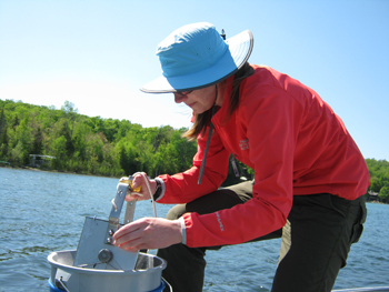
Mkwanibising
Description and Background
Walloon Lake is a glacier formed lake serving as the headwaters to the Bear River, a 14.6 mile river flowing into Little Traverse Bay of Lake Michigan. The lake resides within two counties, Emmet and Charlevoix. There are three tributaries that flow into Walloon Lake with the majority of water intake coming from groundwater. Walloon Lake consists of five basins with a total surface area of 4579 acres. The north arm is shallower than the west arm with the deepest depth being approximately 15 meters. The northern basin in the west arm known as Mud Lake is less than 5 meters deep in the deepest area surrounded by forested wetland. Mud Lake is home to mute swans, a variety of frog species, fish, sand hill cranes, blue herons, and a bald eagle. The Walloon Lake Trust and Conservancy have been trying to conserve areas of land surrounding this basin for quite a few years. The three other basins within the west arm are similar in depth ranging from approximately 24 to 30 meters and similar in physical characteristics.
This lake is one of the most popular and highly used recreational lakes within the LTBB treaty delineated reservation boundaries. One reoccurring issue reported by swimmers and recreational users on Walloon Lake is Cercarial dermatitus, also known as swimmer’s itch. Walloon Lake Association is collaborating with Thomas R. Raffel, an assistant professor in the Oakland University Department of Biological Sciences to look for correlations among the variables that might be useful in predicting and controlling populations of the parasite that causes swimmer’s itch. Current recommendations to avoid swimmer’s itch are to discourage feeding of waterfowl, towel dry after swimming, and avoid swimming in areas of shallow water on days with high water temperatures or high populations of snails and waterfowl.
There are three monitoring locations on Walloon Lake. WNL2 is located in the north arm, WNL3 is located in the middle basin of the three similar basins in data characteristics located on the other arm and WNL5 is located in the northern basin referred to as Mud Lake.
Tribal Uses and Attainment
The primary Tribal use on Walloon Lake sites WNL2 and WNL3 is CF. WNL5’s the primary Tribal use is IAW. Other Tribal uses applied are IAW and PC (May through October). All uses are supported for this reporting period.
LEGEND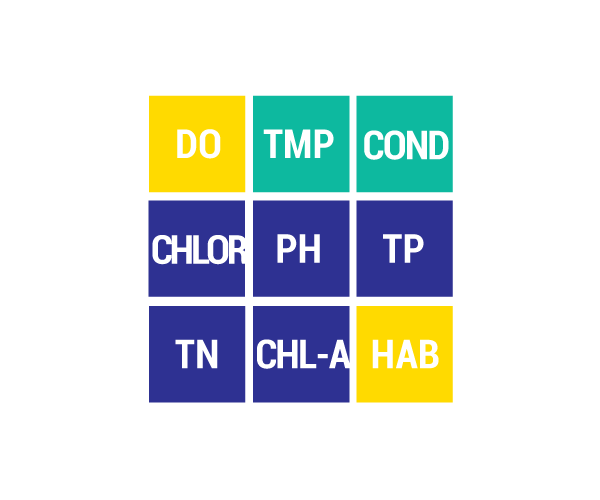
DO Dissolved Oxygen
Respiration for fish, other aquatic organisms
TEMP Temperature
General aquatic life support and reproduction
COND Conductivity
General aquatic life support, dissolved solids indicator
CHLOR Chlorides
General life support, salinity indicator, drinking water pollutant
PH Potential Hydrogen Ion Concentration
Acidity/alkalinity indicator, drinking water pollutant
TP Total Phosphorous
Major algae nutrient, fertilizer/manure runoff indicator
TN Total Nitrogen
Major algae nutrient, drinking water pollutant, fertilizer/manure runoff indicator
CHL-A Chlorophyll-a
Algae concentration indicator
HAB Habitat
Instream and riparian structure to support life cycles of fish and other organisms
MAC Macroinvertebrates
Indicator of water quality based on the diversity of pollution tolerant and intolerant
aquatic insects and non-insects that are visible to the naked eye and do not have a backbone
TSS Total Suspended Solids
Indicator of aquatic life support, oxygen levels
FQA Floristic Quality Assessments
Indicates quality of wetland based on the plant community present
CONDITION INDICATORS
Poor Fair Good Very Good